Great Nebraska
Naturalists and Scientists1
Cover
Field Notes 1911
2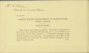
Pastedown
R.J. Pool Sta. A. Lincoln, Nebr.
Form 289.
United States Department of Agriculture, Forest Service.
Notice.
This book is Government property. The finder is requested to mail it to THE FORESTER,
Washington,D.C., or to deliver it to any officer of the Forest Service. A detachable
addressed frank will be found on the last page. By pasting or tying this on the outside
cover the book may be mailed without postage or wrapping, if fastened shut.
3
Flyleaf
Field Notes on the Vegetation of the Sandhills 1911
4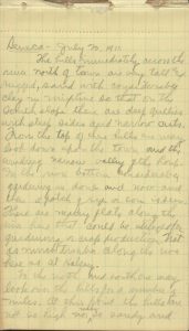
1
Seneca — July 20, 1911.
The hills immediately across the river norht of town and very tall and rugged, sand
with considerable clay in mixture so that on the south slope there are deep gullies
with steep sides and narrow cuts. From the top of these hills we may look down upon
the town and the winding narrow valley of the Loup. In the river botton considerable
gardening is doen and now and then a patch of rye or corn is seen. There are many
flats along the river here that could be utilitzed for gardening or crop production.
Not as much timber along the riva here as at Halsey.
To the north and south one may look over the hills for a number of miles. At this
point the hills are not so high nor nearly so sandy and
5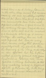
2
wind blown as at Halsey. Blowouts in the active stage are rare but numerous cases of old and completely vegetated
blowouts. From this point one look over inumerable low hills with depression shallow
& grass covered to the rolling horizon beyond. Here and there a green spot and the
and the windmill of a Kuicarda shows in a narrow valley. The valleys here are not well defined but there are many
short narrow valleys that grade insensibly into the pockets. Then the beginning of
the long arid valleys is also apparent but the bottoms instead of being covered with
grass hayland is thrown into those peculiar rolling hillocks so that hay making would
be difficult. South of the river the hills are of the smae gneral character as northward.
6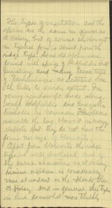
3
The types of vegetation and the species are the same in general as at Halsey, but of course the blowout in typical form is absent from the ridge type. Some old
blows were found with spring of Redfieldia still persisting and many lesser types of Muhlenbergiaare scattedred over the hills to a wider extent. In young windswept areas along roads
Redfieldia and Eragrostis trichodes is common. There places resemble the two blowout in many respects. But they do not
have the form nor size of blowouts.
Apart from blowouts the ridge type is well developed and of the same characteristics
as at Halsey. Linum rigidum is considerably more abundant on the plants than at Halsey and in general this type is here somewhat more thickly
7
4
covered than in the Halsey region. The sand does not show thru the vegetation so distinctly here. on the lower
side of the north slopes thickets of Symphoricarpos occidentalis with Rosa arkansana and Ceanothus ovatus well found. Yucca glauca occupies its usual place.
In an old blow out near the road N. E. of town found a Rhizome of Psoralea micrantha with 39 offshoots six 12 ft. to point where the main rhizhome because trifurcate.
A plant was found in a wash with an enormous spindle—shaped root. The root had been
washed out until 5 ft. of it was exposed with a number of latuals. Root was light
clay color and deeply furrowed longitudinally with a small plant at the top(photo)
the plant had narrow linear leaves much washed stem which was purple.
8
5
This is Stomaca Ceptophylla. The root has much woody tissue surrounded by a corky cortex. Growth rings are very
conspicuous as also are latex glands. In thicket place root was 4 1/2 in. in diam.
Along river east of town near water (6ft) several layers of slate colored shale with
less hardened lighter colored clay between the layers.
There river here cuts into banks badly in grass sod (Phot) (B. hisputa & Bologostachys)
Between Seneca and Mullen over which territory Hartley and I walked the hills are about the same as at Seneca. Numerous red cedars, J. scopulorum, were seen on the upper slopes on all esposures altho mostly confined to the upper
north exposures. Here the soil contains considerable clay and the erosion figures
are much more pronounced. In some places
9
6
fantastic figures have been cut in the clay — sand by water & wind. About five miles
west of Seneca the R.R. leaves the river and strikes thru the hills to Mullen. From this point on numerous cuts have been made in which considerable trouble is
given because of the sliding sand. The company has erected sand fences to prevent
the blowing of sand in the cuts out over the track. Orozopas cuspidata and Ipomoea leptophylla are very common plants in there cuts at this point.
Very little agriculture is attempted in the valley in this region altho it would seem
that such would yield substantial returns. The Ash along north exposures & yucca on
norht hills are conspicuous throughout the this stretch of sand hills.
10
7
Plants Grazed by Cattle (Halsey)
- On fire guard etc.
- Helianthus petiolaris (close)
- Prunus besseyi (much)
- Andropogon hallii (little)
- ” scoparius (little)
- ” frucatus (much)
- Calamovilfa longifolia (close)
- Lygodesmia juncea (little)
- Lacinaria squarrosa(little)
- Anogra pallida (much)
- Helianthus scaberinnus(much)
- Prunus demissa (little)
- Bouteloua hirsuta(close)
- Bulbilis dactyloides(close)
- Koeleria crislata(close)
- Tradescantia virginiana(close)
- Thelesperma gracile(much)
- Hymenopappus filifolius(much)
- Kuhnistera candida(much)
11
8
- Kuhnistera purpurea(much)
- Khunistera villosa (little)
- Asclepias arenaria (little)
- Panicum capiellare (much)
- Psoralea micrantha(little)
- Bouteloua ologostachys (close)
- Rumex venosus (much)
12
9
Halsey
General: In this portion of the sand hills the hills are very rugged and windblown
at present. there are many active blowouts and such habitats that show all stages
in vegetation phenomena. Back from the Loup valley there are scarecly any valleys
at all what valleys there are are very narrow and short. Consequently hay land is
at a premium in this part of the hills. The valleys are but large “pockets” in the
hills rarely exceeding 100 yds wide and 600 yds. long. In some there hay is found
that is cut by the ranchers but the yield is always low and not to be compared with
that of the valley far to southwest in Cherry Co.where the hay valleys
13
10
are very extensive. From the Loup to the Dismal at this point the hills stretch in unbroken monotony, which with the absence of valleys
or other striking second feature becomes extremely wearisome to one travelling across.
The hills here of course as always show the marks of former wind activity by this
general contour and the action of wind at present is also only striking in the blowouts.
In querae the appearance isn every direction is that of numerable rolling billions
of hills sketching are far as the eye can reach, broken at this point only by the
narrow valley of the Loup. The most striking landscape characters aside fromthe hills thereunder are the Bunch
Grass and the Blowouts.
The Vegetation:
In Thomas Co. and pretty generally throughout the hills the
14
11
the following vegetation types can be quite clearly distinguished:
- 1. The Ridge Type
- 1 The Upper Slopes (nic Blowouts)
- 2. The Lower Slopes
- 3. The Bottom Type or (nic lakes)
- 4. The River Flats
- 5. The River Thickets
1. The Ridge Type.
This type is confined the highest points in the hills and may be either more or less
of a linear ridge where a number of hills join or it may be simply the tops of individual
and separated hills. Here as found the maximum exposure to both the drying and the
mechanical effects of the wind which at times in the spring and fall is timber and
the vegetation of this type is consequently most effected by this factor of any in
the hills. The most characteristic plant of the type is Yucca Glauca which
15
12
occurs in more or less abundance on nearly every hill in the whole Sand Hill Region. On some hills there are a few small plants while on others the ground is
almost entirely taken by the species. The plants are mostly confined to the south
and west exposures of the type Altho occasionally some specimen are met with on north
exposures. Because of its deep woody root and xerophytic leaf structure the plant
is well adopted to the conditions imposed upon it by the regions of its habitat. Oftentimes
the sand is blown away from the slim root for considerable depth and yet the plant
lives on, very frequently putting forth new shoots from the exposed roots. On many
hillsides the yucca acts a only very efficient sand binder. This is especially time
where the cattle have made their numerous paths aloud the
16
13
hillside thus forming sowing th so called “cat steps.” In such situations if it were
not for the yucca the whole hillside would slide on be blown away. This condition
is especially well defined between Seneca and Mullen and at Seneca. There is not question
but that the “cat steps” in the sand hills are formed in this way because a great
many stages afford a complete developmental series from the mere first fatter path
on the hillside to the well developoed “cat steps” of the rugged and cut slope of
the feral condition.
Yucca has little economic value in the hills aside from its important roll in the life
history of the ridges & hill tops. However, it is grazed to a limited extent by cattle.
This is especially true when the plants are in blossom, the cattle are frequently
 17
17
14
stripping ever flower from the alre panicle or spike. Such a process frequently results
in producing butter milk & butter where milk cows are allowed to graze where there
is much yucca. I have even seen cows eat the green seed pods where the range was very short so
that in a close range mature fruits of the yucca are seldom developed.
Other plants of these appear slopes are Canathus ovatus whcih is quite common especially on north facing slopes in communities of clumps
made up of the much branched low bushy plants; Rhus radicans and Prunus demissa wander up from the river thicket and with Rosa arkansana form extensive areas on north slopes; Prunus besseyi is of course very common here also it being one of the most ubiquitous plants of
the whole S.H. region. It
18
- >Meriolix serrulata
- Eriogonum annuum
19
15
occurs in almost every habitat but the river thickets, even getting into blowouts.
However it is most at home on the upper portions of the north facing slopes, especially
so in the central sand hills. Redfieldia flexuosa, Muhlenbergia pungens and Calamovilfa longifolia because of their relation to blowouts are also frequent members of this type. These
grasses occur in the type most commonly on the sight of old blowouts or blowouts partially
established. Andropogon hallii is also a very characteristic high land plant showing in a small measure the bunch
grass habits of A. Scoparius, and A. fucatus of the lower areas.
Now and then the shrubly thickets of the type are found on the very rim of blowouts
serving as very efficient sand binders and checkers of the advancing crater. Frequently
the
20
16
roots of these plants, especially R. radcicans, P. besseyi, and P. dimissa, form a straggling fringe surrounding the crater that reaches down into the blowout
of several feet. this is usually below the distinct fringe at the very edged of the
crater that is formed by the roots and rhizomes of the grasses especially Redfieldia, Muhlenbergia and Calamovilfa and A. hallii. (see photos for these characteristics)
From the above discussion it is seen that the vegetation of the ridges and upper slopes
is spared, and that it is composed of relatively few species. The bunch grass, A. scop., and Yucca glauca giving the usual tone to the type are scattered in characteristic style with rather
wide interspaces in which the sand is very frequently conspicuous and at a distance
show thru
21
17
the vegetation in a striking manner. In there interspaces and among the plants in
the shrubly thickets numerous secondary and widely scattered species occu. Among the
most common of these are: Linum rigidum,Thelesperma gracile, Hymenopappus filifolius, Lacinaria squarrosa, Talinum teretifolium, Stipa spartea, S. comata, Psoralea lanceolata, Euphorbia geyeri, Chrysopsis villosa, Asclepias arenaria, Acerates viridiflora, A. angustifolia, the Kuhnisteras.
The south upper slopes are typically much more barren than the north upper slopes
and the snd spots are usually more conspicuous on the south exposures.
The blowouts can be best treated in connection with this type since they are phenomena
of the upper ridges and hilltops and are therefore properly habitats of the type
22
18
under consideration. Blowouts are depressions of varying depth depending on the age
blown out from the hills by the wind. They are usually formed on the west sides of
hills, but they may range from S.W. thru W. to N.W. The greater number haver their
origin on the N.W. face of the hill. In such spots when the vegetation becomes broken
or uprooted from any cuae the wind catches the sand and carrries it over the crest
of the hill and deposits it on the lee face of the hill upon which over everyonce
blowout has its origin. The two chief forces that enable the wind to begin its work
are cattle and fire. By constant trailing over the hills the cattle very frequently
destroy the vegetation thus queing ready birth to the embryonic blowout. So also in
the case fo fire
23
19
which does ever a much finer job them the grazing animals we have a very common predisposing factor in the development
of blowouts. From such a small beginning the blowout rapidly enlarges and the wind
continues to dig out sand & carry it over the crater region. Such objects are very
commonly developed on fire guards, and in fact the ranchers attempt to stimulate blowout
formations on fire guards because by so doing the guards is all the more effective.
Such fire guard blowouts are interred & of being naitve form as on hills tops of typical
form often become of great linear extent, 100 — 300 ft. by 10 — 12 ft. wide and 10
— 15 ft. deep. In such cases the bottom of such “sand sweeps” are very commonly strewn
with the roots of various species especially the
24
20
woody members of the flora such as Rhus Rosa, and Prunus. In such active state the blowout may continue for many years without a single sucessful
invasion. As the depressioin becomes deeper and deeper the “sand hill” becomes a characteristic
feature and finally the rim of crater is so far above the bottom that the wind effect is lessened and Redfieldia
establishes itself near the bottom of the depression. From this point it spreads by
rhizome propagation upward and outward, but continues for a time to be the only species
albe to cope with the conditions. Sooner or later however other plants invade and
the blowout begins its decline as far as the wind effect is concurved. Among the earliest
invaders after Redfieldia are: Psoralea
25
Clumps of A. hallii that have slid into blowouts and have then become established.
26
21
Micrantha, Phaca longifolia, Lygodesmia juncea, Eragrostic trichodes, and Chrysopsis villosa. After these have thoroughly fixed the sand Psoralea micrantha becomes very abundant and then comee the bunch grasses. A. hallii and A. scoparius and from this time on the sand blows only at the tops of the rapidly declining blowout.
Muhlenbergia pungens because of its mat forming ability is as an important plant at this stage. Often
this species is very conspicuous on these upper slopes and the crater rim of a rapidly
declining blowout.
The importance of rhizome propogation in blowout invaders cannot be overestimated.
Because of the presence of blowouts on the west faces and the rounding form of the
hills on the east slopes we get very different views as we
27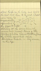
22
stand high in the hills and look to the east and then to the west. A section may be
diagramatically represent by the figure at right showing at the same time the general
east & west trend of the ranges of hills characteristic for the whole sand hill region.
Bouteloua hirsuta in this type.
28
23
2. The lower slopes.
In comparision with the upper slopes and ridges the lower slopes are more thoroughly
covered with vegetation. This is especially true of the north facing slope where this
type becomes most clearly differentiated. On the north exposures the soil is distinctly
less xerophytic, even becoming very mesophytic in certain places. Very frequently
thru this region one sees belts of willow (S. humillima, and S. longifolia) and Cornus stolonifera low down on north slopes. Amorpha cancelens is aloso very abundant, in places being controlling and and even Amorpha fruticosa is very commonly see rather high on north slopes in a habitat far removed form the
ridge thicket where it is most at home. The brushes are commonly in
29
24
clumps about 3 — 4 ft in height and comver considerable territory;. In a narrow valley
3 mi. east of Halsey a grove of Populus tremuloides trees found in this location.
The trees were about 25 ft. in height, and 15 yrs. old. the grove. The grove covers
about 10 and in stand is quite characteristic for the species.
In many places water seeps out in this type which of course accounts for the species
found there, and the seepage is accounted for by the outcropping of or the coming
close to the surface of clay or shale beds. Among the bushes of these belts such plants
as the following are common: Anemone cylindrica, Stachys palustris, Monarda fistulosa, Koellia virginiana, Tradescantia virginiana, Cornelius oiquica, Specularia perfoliata, Juncus balticus, Habenaria hyperborea, Marchantia polymorpha, Bryum roseum, Cladonia
30
Vaquera stellata communities here, also scatterd Polygonatum commutatum and Prunella vulgaris
Arctostaphylos uva-ursi
31
25
and others
On the south facing slopes the type is not so distinct altho even there willow belts
are occasionally seen, but perhaps the most common shrubly plant in thicket community
here is Prunus americana. Very many cases of thickets of this species 200 — 500 fett across were seen in such
situations. The other two Pruni are rearely seen here altho P. besseyi is abundant over the upper portions of the south exposures. Rarely groves of Celtic occidentalis are met with in such situationsl also but such are only case. About seven miles southwest
from Halsey is a hackberry thicket containing a haonery. A very common place for such thickets is on the northwest face of a packet. Many
species especially of the grasses of the about type of course wander over and thru
this type. The bunch grasses are
32
26
controlling as in most places.
33
27
3. The Bottom Type.
This type occupies the very bottoms of pockets are narrow valleys in the central Sand
Hills region. Its conspicuous vegetative difference as compared with the above types
is its dense sod composed of a number of species of grasses the chief of which are
Andropogon scoparius, A. hallii, A. furcatus, Bouteloua hirsuta, B. oligostachya, Panicum virgatum, P. capillare, P. wilcoxianum, Calamogrostis canadensis and Koeleria cristata. Because of the sod here competition is the fiercest of any of the habitats in the
hills. The roots of most of the species go deep (7 — 6 ft.) and very soon drain the
soil of its moisture even after a heavy shower. This soil contains more humus and
more organic surface mulch than any soil type in the hills aside from the river thicket.
34
28
It is here that the rancher gets the most of his hay and alos where range cattle find
best grazing. It is this type that becomes of so great economic importance as broad
hay valleys in the northern sand hills.
Other plants than the ones mentioned that are common in this type are Carduus plantensis, Lygodesmia juncea, Euphorbia geyeri, Helianthus petiolaris (on broken soil) Cycloloma atriplicifolium, Chenopodium album, Amaranthus torreyi, A. blitoides, Argemone intermedia, Cactus viriforms, Opuntia parishii, and little O. fragilis.
35
29
4. The River Flats.
This type is very well developed along the Middle Loup River and in its typical form is a grassy flat extending from the bases of the nearest
hills on either side of the river to the edge of the river thicket on in many cases
to the very river bank. The plants that characterize the type especially are Bouteloua oligostachyta & B. hirsuta and Bulbilis dactyloides. The former two species constitue by far the greater amount of the sod land in this
type often occupying the ground for many acres in single areas. Bulbilis occurs as more or less completely isolated patches but never becomes of as much importance
as the former two species altho of course it is grazed very closely wherever it is
found. Bouteloua hirsuta is a typical
36
30
hill species while B. oligostachya is the lowland or flat species of the two. Once the wide flat areas of this type
it is a very important grass.
In the Middle Loup Valley this bottom flat varies form 1/4 – 1/2 mile wide and the river flows through the
approximate center altho in places nearer one side of the valley. Often the river
cuts into the grass a sod which caves in in great flat – topped chunks. Then again
the river cuts into the hills very commonly thus causing the sand to slide into the
water and be carried away. In this manner in competition with the wind the river very
often forms great blow slides of 100 – 500 yds extent the lower edge of which comes to the water and the upper edge high in the hills Blow slides
of this sort are seen in fine
37
31
development at Natick and Seneca in the Loup Valley. In such places the underlying soil conditions in the Sand Hills are strikingly bought out. The layers of clay and sometiems shale are conspicuous
on such exposed faces. Over there often well defined strata cascades of sand from
down from above over the steep slope to the water below or are caught by the wind
and hurled high over the hill above. These slides are usually absolutely devoid of
any vegetation and in such places there is no river flat type developed on that side
of the river. The Loup from extensive oxbox lakes on the both sides. In a number of places the R.R. has
aided in this by fills. Such fills are especially prominent at Seneca.
Very commonly the bunch grass has partially invaded this type and where this is true
scattered
38
32
tufts are very striking in the close sod of the type especially on the boundary line
between this type and the lower slope type. Besides the grasses mentioned the next
most conspicuous vegetation is Symphoricarpos occidentalis and Prunus demisa & P. americana that form extensive groups. Often these may extend for 1/4 — 1/2 mile so that the
general grassy nature of the type is broken very effectively in such places altho
the grasses are to be found with within the thickets. Cattle graze there three woody
considerable degree, especially the two Prunni.
Besides these plants this is the type in which the cacutuses show their best development,
Opuntia fragilis occurs very abundantly here in characteristic tufts of
39
33
about 1 ft. in diameter, while O. humilis forms many more extensive colonies. Cactus viriparus is also seen in the type occasionally but is scarce.
In places where the sod has been slightly broken Ambrosia artemsiafolia for stretches of light green frequently in mixture with Lotus americanus are Artemsia guaphalodes. Up nearer the true hills Ratibidia columaris often forms dense communities of wide yards in extent, also Verbena hastata develops this habit. In the drier sodless places Cleome serrulata and Polanisia trachysperma are very abundant the former often forming extension thickets which are transformed
into bright masses of purple the latter part of July when the species is in full flower. Hedeoma hispida and Plantago purshii are also very abundant in this type the
40
34
latter often forming great communities of way stems that almost completely using the
ground.
Fraxinus lanceolata is a very common member of this type especially on the south side next the hills.
The species often focus a conspicuous belt of forest in such places which spreads
farther out on the flat and in some places goes quite high into the hills. Propagates
by root suckers. In these Ash thickets a facits a they really are Rhus glabra and Crataegus coccinea often form extra forestall thickets along with Prunus americana, P. durussa. The Rhus glabra shows a decided hill climbing tendency here as in the eastern part of the state and
is really the outpost of the spreading Ash forests. The Ash is seldom seen close to
the river except in places where the river has cut in clove
41
35
to the hills toward the south limits of the river flat type. The ask is much more
common south of the river than on the north side Celtis occidentalis often forms similiar growth as for instance at Seneca. Parthena
42
36
5. The River Thickets.
Close to the river and frequently extending back 100 yds or more occurs a thicket
association that is often so dense as to me almost impenetrable. This thicket is composed
of Prunus armeniaca, P. dermussa, Crataegus coccinea, Amorpha fruticosa, Cornus stolonifera, Vitis cordifolia and Salix nigra in the main. The Prunis often form extensive thickets of about 6 — 10 ft. mi. height. In other places the
Amorpha predominates; In others the willows and dogwood, and so on. The hay is typically
scattered among the other woody spieces rarely if ever forming extensions pure stands.
Such thickets may extend along the river for several miles and then give way to the
grass and sod of the river feat which abuts directly upon the river. In many places
large specimen of Salix nigra
43
37
tower high above the general level of the thicket from a station in the hills quite
a forest aspect to the type. Small islands in the river are typically of this type,
being marked prominently by the willows.
In this type is found the richest and moistest soil of the whole region. Humus is mixed in with the sand for a depth of 6 — 18 in. so that we have here really a
sandy loam with much organic upon and near the surface. As a consequence of these
conditions and of the rather deep shade of the woody cover the undervegetation of
the ruin thickets is distinctly mesophytic. Beneath the woody plants already mentioned
these occur Ribes floridum, R. cereum, Rhus radicans are abundant under shrubs. Then there are many
44
38
herbaceous species the most common of which are Phryma leptostachya, Circaea lutetiana, Meibomia canadensis, and in the more open places Asclepias syriaca and Lythrum alatum. In the open moister areas places Phragmites phragmites and Eupatorium purpureum and Solidago canadensis are very abundant.
Parthenocissus quinquefolia and Rubus americana are abundant as . Other conspic — hubacious things are Galium triflorum, G. trifidum, Geum strictum ad G. canadense, Fragaria americana, Raquara stellata, Onadea sensibilis, Aspidium thelypteris, Apocynum androsaemifolium, Helianthus tuberosus, Mimulus ringens, M. jamesii, Agrimonia mollis, Celastrus scandens, Muhlenbergia racemosa, Argyreia nervosa, Similax herbacea
45
39
Alliance — Sidney
South of Alliance the railroad dips rapidly for a number of miles and in this way soon drops from the
high plains into a Sand Hill area south of Alliance about Letan where the sand hill region sends a toungue west of the railroad for a number of miles.
Off to the east the main body of sand hills is very prominent and many large blowouts
appear. The vegetation of the hills where the road cuts thru them is very much as
in the central sand hill region save for the comparative absence of bunch grasses
and the presence of sage brush which here becomes a very conspicuous member of the
vegetation. The yucca is very abundant along thru this area often almost covering
whole hillside and so giving a distinctly controlling yucca appearance.
46
40
Here also the yucca is found on all slopes althou the south facing slope is the one
most thickly covered with these plants. Muhlenbergia is very common along railroad embankments.
For quite a distance south of Bridgeport is a rather extensive agricultural region, wheat being the principal crop this season.
This land is relatively flat on rolling table land which supports naturally a close
stand of short grass vegetation, mostly Bouteloua oligostachya, Bulbilis dactyloides and Aristia purpurea. Opuntia humilus is very abundant and yucca is only scattering. A great amount of this land above
Sidney has not yet been broken and has never been under plow. At Sidney we found of perhaps 2000 in the valley of Lodgepole Creek here a small stream in the valley south of town. North of town the rocky bluffs rise
to about 200 ft.
47
41
above the town and outcrops of the rather soft limestone are numerous, between which
are many sharp narrow valleys. Beyond this ridge the country extends for miles in
the same rolling tablelands as above the vegetation of these ridges or outcrops in
much the same as that of the ridges in Pine Ridge of Sioux Co. The presence however of Eriogonum alatum and E. annuum and Homalobus montanus show a much more southwestern tendency already creeping in here. Parosela aurea was also seen here in considerable abundance. Rhus trilobata lies North of Lodge Pole creek a flat abut 3/4 mil in extent is covered with a mixture of short grass and
bottom land vegetation. Along the creek were found such plants as Homalocenchrus oryzoides, Panicum virgatum, Equisetum pratense, Epilobium
47
42
adenocaulon, E. coloratum, and Asclepias incarnata.
Kimball to Harrisburg
Throughout this 25 mi the short grass country prevails with a great amount of Opuntia and Aristida. The soil is gravelly — sandy and the land rolling until about 5 mi. south from Harrisburg a sudden drop is made into the rough land of Banner Co. At this point the road dips suddenly into a deep canyon that extends down between
rocky bluffs to the valley in which the town to Harrisburg is situated. There rocks rise several hundred feet above the valley and in many places
are very rugged. The lateral canyons are very short but deep and the most of them
are dry. These ridges are coverd with the Prunis scap.—
48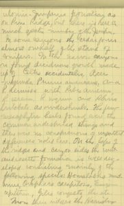
43
ulonim. Juniperus formation as on Pine Ridge, but there is here a much greater number of the Juniper.
In some canyons the cedar forms almost one half of the stand of conifers. In the narrow
canyons is found deciduous growth made up of Celtis occidentalis, Acer negundo, Prunus americana, and P. demissa with Ribes aureum, R. cereum, R. nigrum, and Rhus trilobata as undershrubs. the few mesophytic herbs found were the common widespread things
and there were no conspicuous or important differences noted here. On the tops of
the ridges and canyon sides the mat and rosette formation is well developed consisting
mainly of the following specifics: Homalobus montanus, Orophaca caespitosa, Eriogonum capistratum, Gilia congesta, etc. etc.
From there ridges the Harrisburg
49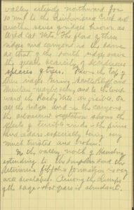
44
valley extends northward for 10 mi. to the Pumpkin seed Creek and another series of ridges known and Wild Cat Mts.. The flora of these ridges and canyons is the same as that of the south ridges save
the greater scarcity of dediduous species of trees. From the top of these ridges Gering, Scotts Bluff and Meridian maybe seen, and to the Westward the Rocky Mts. are visible. On all the ridges and in the canyons the arborescent vegetation shows
the effects of terrible winds — the pines and cedars espcecially being very much twisted
and broken.
In the valley north of Harrisburg extending to the Pumpkin seed the Artemsia filifolia formation is very well developed. Among the clumps of the sage — short grass is abundant.
50
Rear Flyleaf
Forest Service. The Forester, U.S. Department of Agriculture, Washington, D.C. 8-64
U.S. Department of Agriculture Official Business. Penalty for Private Use, $300.